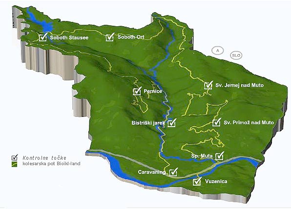
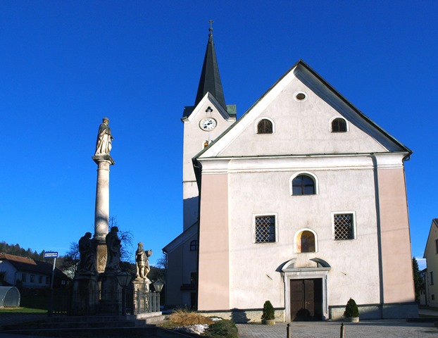
1st start control point – Vuzenica 340. m a.s.l. Here begins the bicikl-land route. Nearby is the arch-parish church of St Nicholas. From the start control point Vuzenica we set off along a narrow asphalt street to the first junction (340m a.s.l.),(0.35km) at which we turn right beside the stadium, whereupon we ride along the priority road which turns to the left(335m a.s.l.), (0.47km), across the bridge over the river Drava. The route rises slightly to the junction of the main road Dravograd-Maribor (350m a.s.l.), (0.88km); we turn right and along the main road ride to the settlement of Spodnja Muta where, on crossing the bridge, at the junction (345m a.s.l.), (2.05km) we turn left towards the settlement. Immediately after the junction the next one awaits us… 2nd control point point -Spodnja Muta 345 m a.s.l., 66.5 km still to the end of the route. The sight nearby is the church of St John. Onwards the route leads us through the settlement and in the square (340m a.s.l.), (2.42km) we turn to the right where the road rises slightly. We continue along the priority road past the blocks of flats and the Muta Smithy where the road begins to climb at a medium gradient through the forest. When we reach the end of the asphalt road (380m a.s.l.), (3.28km) the route continues on the level and leads straight into the forest where it begins to rise slightly. The route takes us past a farm and at the fork (470m a.s.l.), (4.39km) branches off to the right. We ride past a farm, where the route takes us straight on. The route brings us across the farmyard and descends slightly; at the end of the level stretch the route turns left up a slope (530.a.s.l.),(6.98km). After a medium-steep climb between meadows we reach the more rutted road Muta-Sv.Primož (670m a.s.l.), (8.36 km) and continue the route to the left. After a short climb we arrive at the SIGN-Poltnik (690m a.s.l.), (8.74km) and continue the route slightly to the left along a well-rutted road. At a fine viewpoint (820m a.s.l.), (10km) there follows a slight descent to the next control point. 3rd control point point -Sv. Primož nad Muto 810 m a.s.l., 58 km still to the end of the route. The sight nearby is the church of St Primus. After 50m of asphalt surface the route branches off to the left into an easy descent. At the fork by the Naglič farm (775m a.s.l.), (13.33km) we continue the route along the left cart track, which brings us to the junction Sv.Jernej-Bistriški Jarek-Sv.Primož (710m a.s.l.),(15.71km) and there we turn right into an easy climb, which brings us to the SIGN by the farm and at the junction (820.a.s.l.),(17.75km) we turn sharply right up the slope. The route brings us to the next point. 4th control point point -Sv. Jernej nad Muto 1020 m a.s.l., 48 km still to the end of the route. The stamp is located at the nearby Primož (Nanta) farm. The sight nearby is the church of St Bartholomew. We turn right across the meadow towards the forest where there is a SIGN (1020m a.s.l.),(21.04km). On entering the forest a medium-demanding short descent awaits us, which brings us to the sign »state border« (1005m a.s.l.),(21.23km); we continue to the right along a level forest track where we cross the state border (1000m a.s.l.),(21.47km) and reach a chapel, and we continue the route to the left across a meadow, approx. 50m of climb. When we reach the asphalt surface (1010m a.s.l.),( 21.59km) the route continues to the left along the road. When we reach the junction of the main road (920m a.s.l.),(27.9km) we turn left and the route leads us across a bridge. The route is varied (slightly downhill and slightly uphill). At the junction for Soboth (1055m a.s.l.),(34.55km) we turn left towards the settlement and the next control point. 5th control point point – the place Soboth 1050 m a.s.l., 34 km still to the end of the route. The sights nearby are the Jakobihaus exhibition space and the church of St James. The road takes us on through the settlement and after a short climb we come back again onto the main road (1060m a.s.l.),(35.93km) onto which we turn left. There follows a short descent then across a bridge, up a slope and then the last descent to the Golica dam (1070m a.s.l.),(39.9km). 6th control point point – the Golica dam 1070 m a.s.l., 34 km still to the end of the route. The sights nearby are the Jakobi haus exhibition space and the church of St James. We ride along the road across the dam and then into a short climb where at the junction (1140m a.s.l.),(40.79km) we turn left for Laken. There follows the end of the asphalt road (1130m a.s.l.),(41.04km) and a descent to a fork where we ride straight on (1090m a.s.l.),(41.52km). The road descends slightly throughout and throughout we keep to the main link, and when we reach the junction (965m a.s.l.),(48.32km) where the route turns slightly uphill in the direction of Pernice we turn right and after a few metres reach the state border (960m a.s.l.),(48.5km) whereupon there follows a short descent to the Herman farm (935 m a.s.l.),(48.93km). 7th control point point – the place Pernice 935 m a.s.l., 20 km still to the end of the route. The sight nearby is the Herman chapel. From the farm onwards we set off into an un demanding descent on which throughout we ride straight on at the forks. When we reach the SIGN and the signpost for Bistriški jarek – border crossing – Pernice (800m a.s.l.),(53.08 km) we turn sharply left into a steep descent along the road. At the next junction (740m a.s.l.),(54.20km), where there is a SIGN, we again turn left. When the route brings us to the beginning of the asphalt road in Bistriški Jarek (460m a.s.l.),(58.77km), on the left-hand side there is an old military guardhouse. The asphalt road takes us along the valley beside the stream to the next control point. 8th control point – the Ecological Chapel 425 m a.s.l., 8.5 km still to the end of the route. The sight nearby is the Sedelnik waterfall. The route takes us on further along the Bistriški Jarek and at the end the route branches off to the right across a bridge up a slope. At the top of the slope (395m a.s.l.),(65.05km) at the junction we ride straight on onto a gravel road, along which we continue the route to the forest where there is a SIGN (390m a.s.l.),(65.51 km) and there we turn right to the next SIGN (390m a.s.l.),(65.68) where we ride straight on. The route takes us along the forest and meadows where we again come to a SIGN (385m a.s.l.),(66.28km) and there we turn right towards the main road where the next control point is. 9th control point point – Caravaning 385 m a.s.l., 2.72 km still to the end of the route. The sight nearby is the Roman road. Onto the main road we turn left where a short level stretch awaits us and then the last bigger descent. At the end of the descent (370m a.s.l.),(67.75km) at the junction we turn right in the direction of Vuzenica. And the circle is closed. We continue the route along a slight descent across a bridge and at the junction for the bus station we turn right (340m a.s.l.),(68.17km). We continue the route straight on, there follows a slight downhill and after that the junction for Primož na Pohorju (335m a.s.l.),(68.57km), where we turn left through the underpass. At the next fork (335m a.s.l.),(68.81km) we turn onto the non-priority road (left) and before us appears the church at which we began the route (340m a.s.l.),(69km).
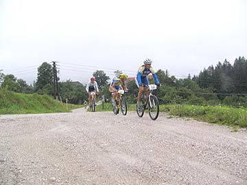
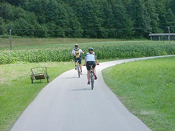
Ride the whole course of this wonderful route, which runs through the municipalities of Vuzenica and Muta in Slovenia to the municipality of Soboth in Austria and back.
Stop at the 9 checkpoints, where in the nearby inns and farms you will get a stamp and sign the guest book.
Near each point, take a look at the cultural and natural sights of the individual place.